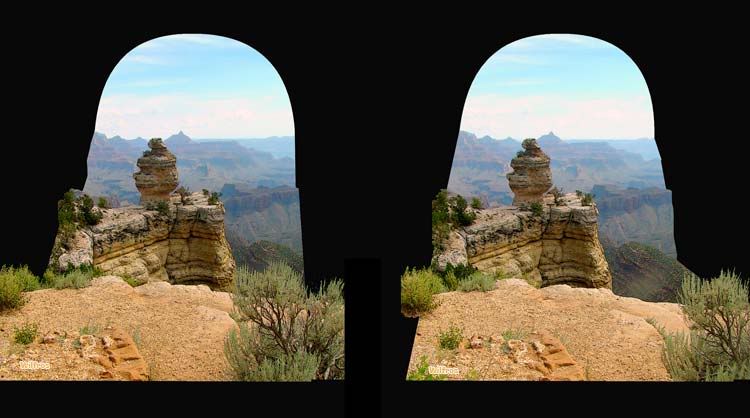
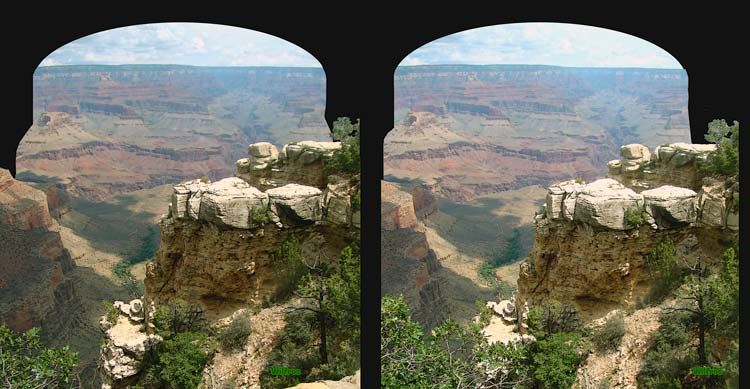
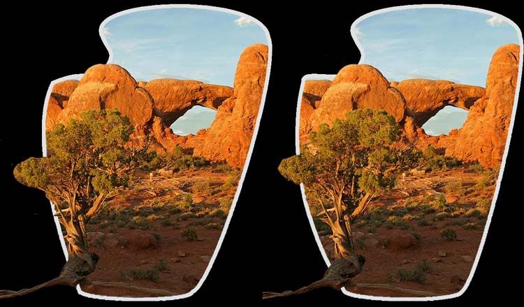
For the past few days I have been trying my hand at making the 3D Borders (showen earlier).
The photos below are my latest attempts. Obviously I still have a ways to go, but I said I would post my attempts so you could either watch my failures or give comments on how I can improve.
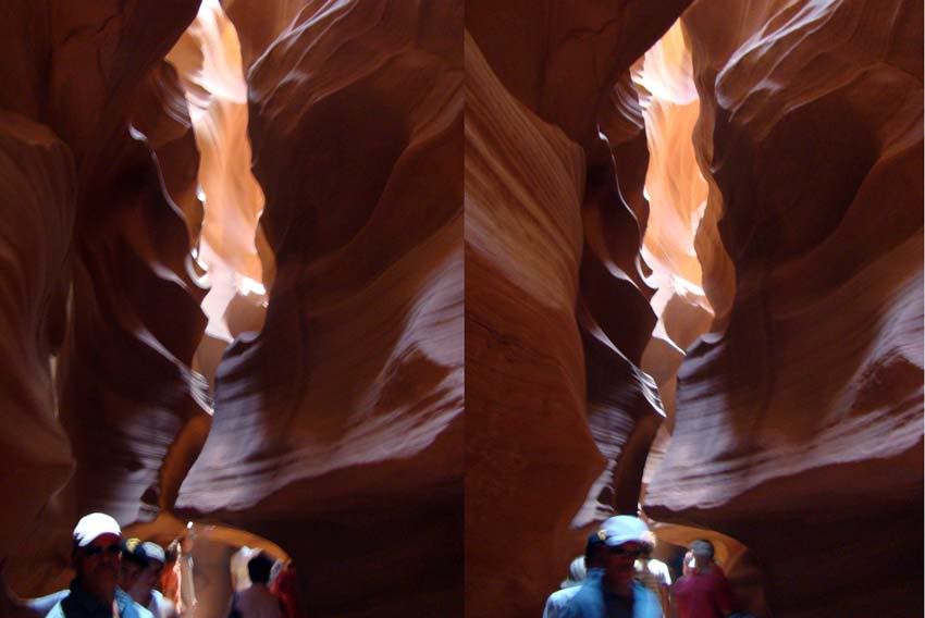
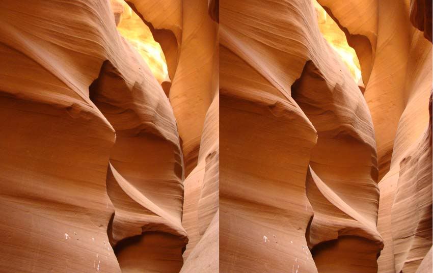
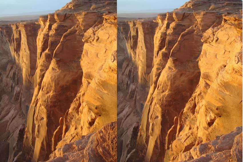
A slot canyon is a narrow canyon, formed by the wear of water rushing through rock. A slot canyon is significantly deeper than it is wide. Some slot canyons can measure less than one metre (3 ft) across at the top but drop more than 30 m (100 ft) to the floor of the canyon.
Most slot canyons are formed in sandstone and limestone rock, although slot canyons in other rock types such as granite and basalt are possible. Even in sandstone and limestone, only a very small number of creeks will form slot canyons. This is due to a combination of the particular characteristics of the rock, and regional rainfall.
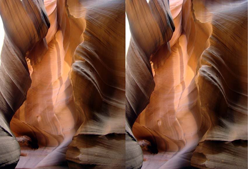
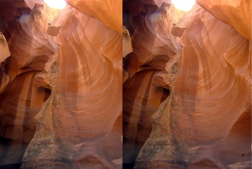
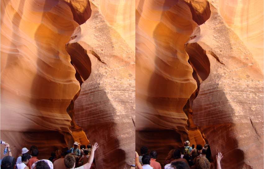
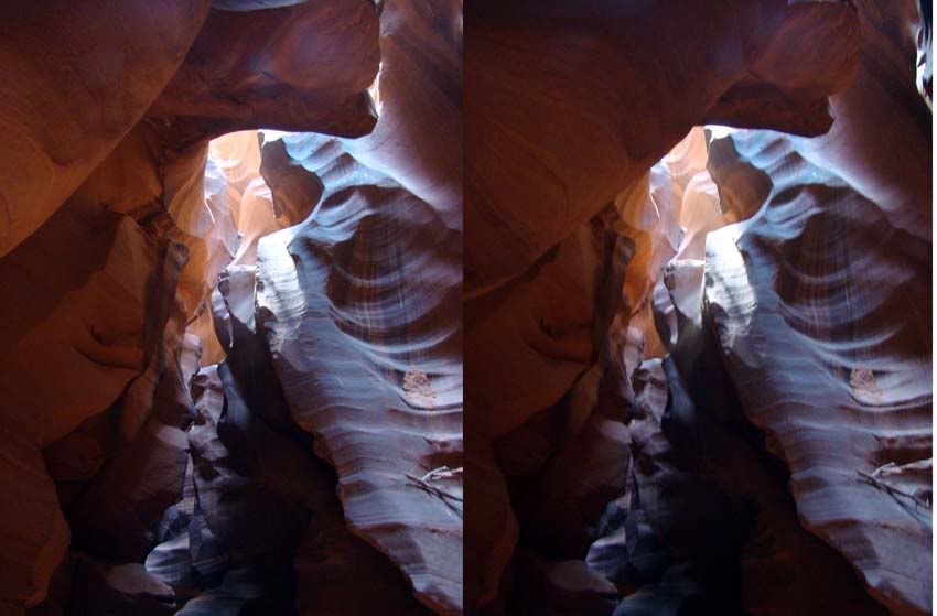
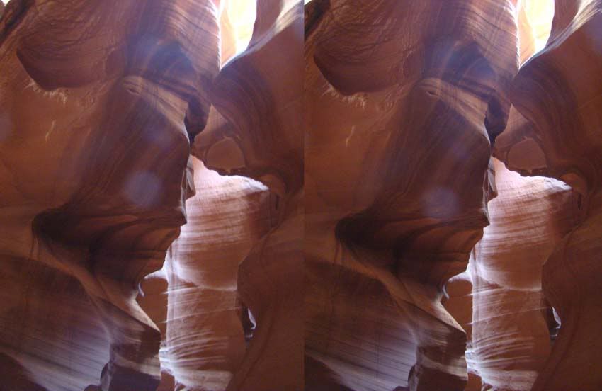
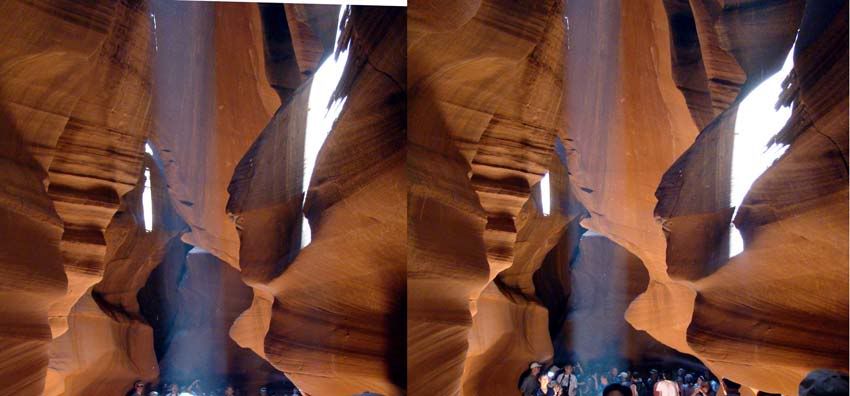
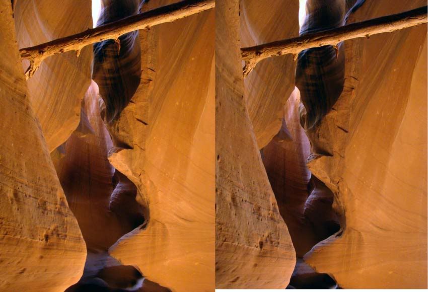
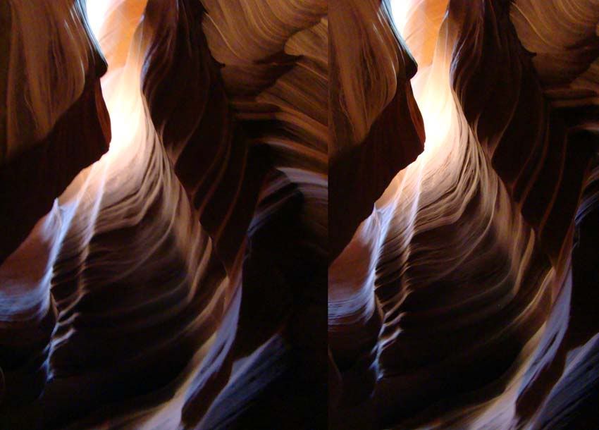
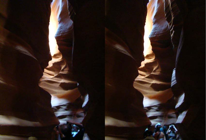
Antelope Canyon is at once one of the most breathtaking and tranquil places on earth. Gently carved from the Navajo sandstone over the course of countless millenniums, the slot canyons are majestic and narrow passages, just enough space for a small group to walk the sandy floor - and for the occasional shafts of sunlight to shine down from above.
It is really two separate canyons - Upper and Lower Antelope. Each contains the hidden "slots" carved from the swirling sandstone, and both drain from the south into Lake Powell (once the Colorado River). The canyons are so narrow in places that one can stretch out his or her arms and touch both sides.
The Navajo name for Upper Antelope Canyon is Tse' bighanilini, which means "the place where water runs through rocks." Upper Antelope is at about 4,000 feet elevation and the canyon walls rise 120 feet above the streambed. Lower Antelope Canyon is Hasdestwazi, or "spiral rock arches." Both are located within the LeChee Chapter of the Navajo Nation.
Though dry most of the year, Antelope Canyon runs, and sometimes floods, with water after rains. It is the water, slowly wearing away the sandstone grain by grain, that has formed the beautiful and graceful curves in the rock. Wind has also played a role in sculpting this fantastic canyon
History:
A long time ago, herds of pronghorn antelope roamed freely in Antelope Canyon, which explains the canyon's English name. It is not known exactly when people first discovered Antelope Canyon. According to local Navajos, who have lived here for some time, the canyon and the LeChee area were places where cattle grazed in winter.
To older Navajos, entering a place like Antelope Canyon was like entering a cathedral. They would probably pause before going in, to be in the right from of mind and prepare the protection and respect. This would also allow them to leave with an uplifted feeling of what Mother Nature has to offer, and to be in harmony with something greater than themselves. It was (and is) a spiritual experience.
I found another Fantastic 360 interactive panorama from the same site as below but this one of Antelope Canyon and thought I would let you all see it. I encourage you to visit the host web site, it is well worth the visit. Click here
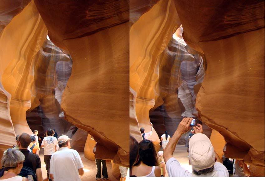
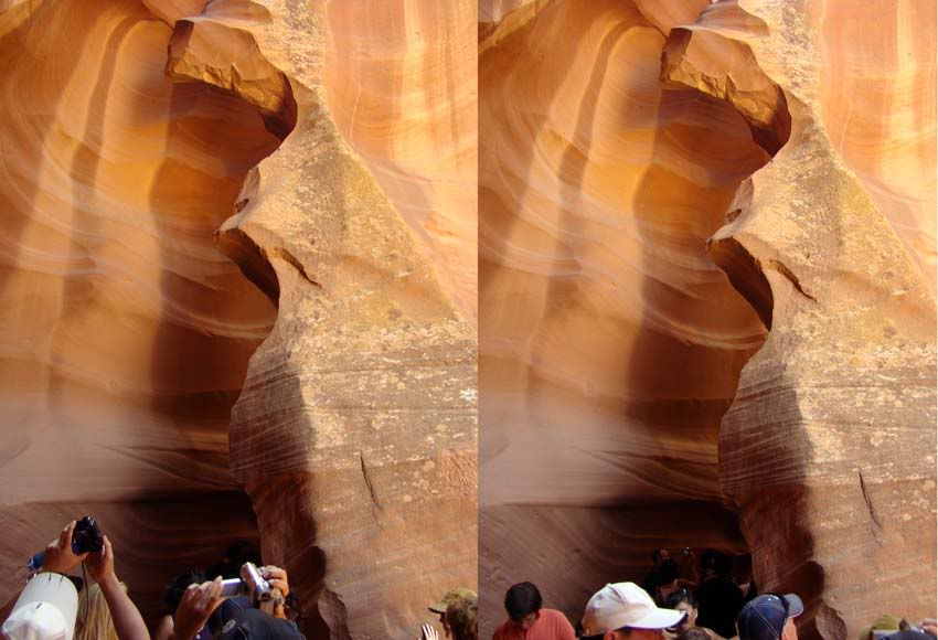
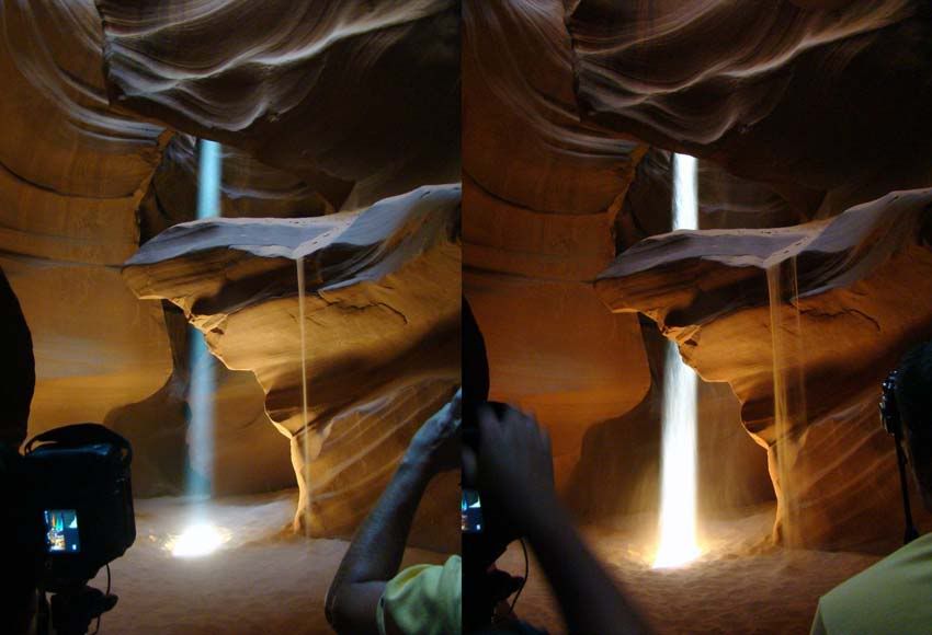
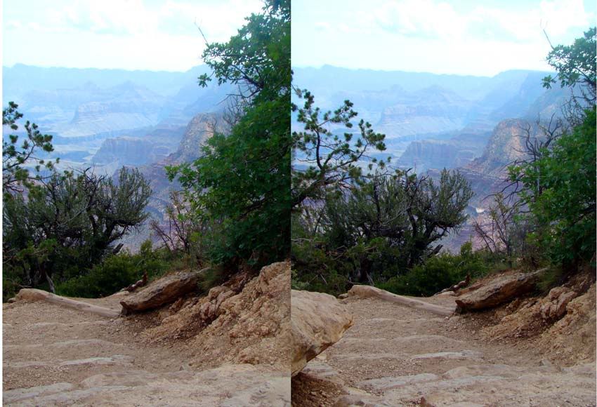
The day we visited was a popular day, thus many others were crowded into the canyons along with us.This gave me little to no opportunity to take good quality 3D photos.This, complicated by the close quarters, did not allow me to get views that allow for definition or context.
Viewing these photos do not do this site justice.Perhaps some day I will get another chance to visit this canyon and try again.In hindsight there are many things I would do differently to better capture the spirit of the site.
Well, Thank you for letting me revisit our great trip to Arizona.
I called this blog "3D Cruiser" because I want to focus mostly on our cruise voyages. Next post, we start with our cruise on Caribbean Princess.
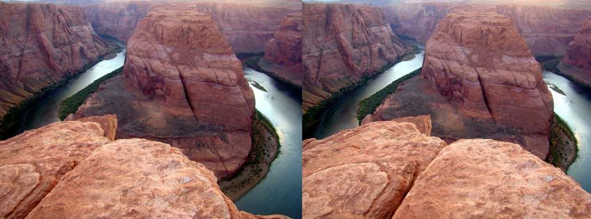
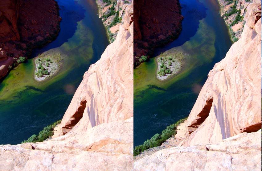
I found this Fantastic 360 interactive panorama of Horseshoe Bend and thought I would let you all see it. I encourage you to visit the host web site, it is well worth the visit. Click here
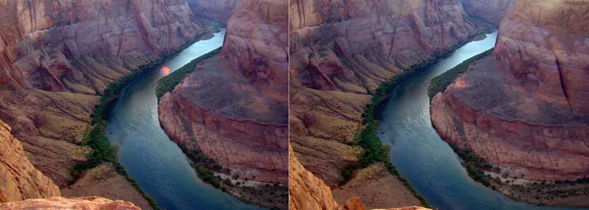
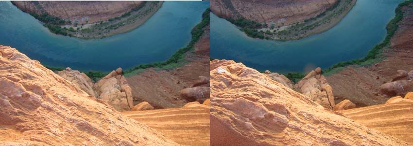
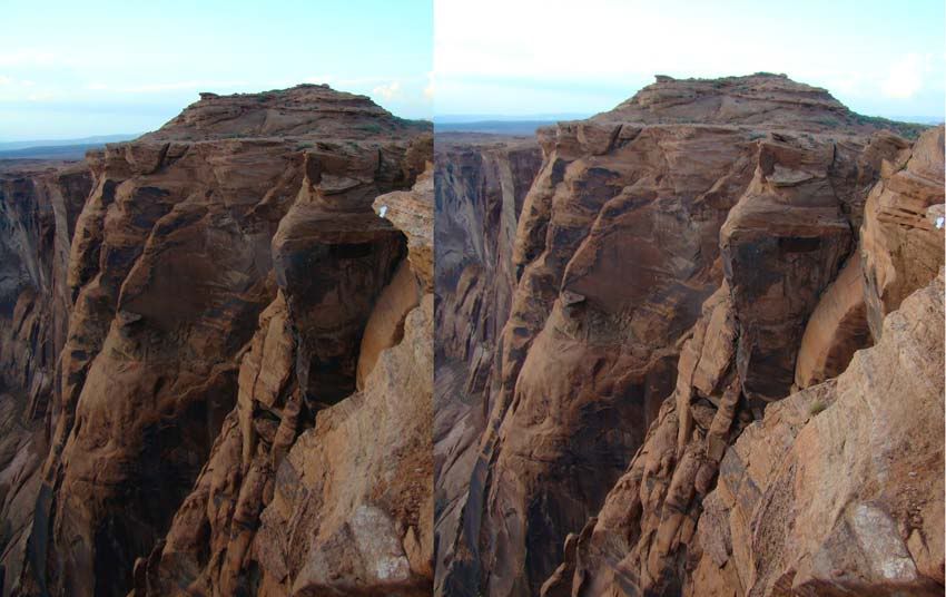
The Colorado River makes a nearly 360-degree bend in its canyon here, leaving a towering butte in the middle. It's an impressive sight and may make you wonder why the river didn't just cut straight through! The trail is just 0.75-mile long one-way and crosses a sandy ridge to a viewpoint high above the river.
Horseshoe Bend is right on the way to Page. Just about five miles south of Page, on Hwy 89, one should lookout for a small signboard that reads "Horseshoe Bend Overlook". It's extremely easy to miss this signboard, so one has to closely look out for it. If you've reached the intersection with Hwy 98, you've gone too far. If you are coming down south from Page, there is a signboard on that side as well. Make a turn westwards at the signboard, and in less than a quarter of a mile the road should end at a small clearing where cars could be parked. Because this location is unknown to most tourists to the Grand Canyon, this parking lot usually has ample empty spots. From the parking lot, the overlook is three quarters of a mile away. There is a well-marked trail that leads to the overlook. However, the trail consists mostly of loose desert sand and it can be a very strenuous hike. So carry lots of water or other fluids.
As you walk down the trail, loose desert sand gives way to sandstone rocks that date back to the early Jurassic period. Over millions of years, wind and water have eroded these rocks to create absolutely weird, but awe inspiring shapes and patterns.
Upon reaching the overlook, one is awed by the magnificence of the landscape that cannot be expressed in words or through a photograph. The overlook is at the top of a steep orange colored cliff several hundreds of feet high. Down below, an emerald green Colorado River makes a horseshoe shaped bend before rushing towards the Grand Canyon.
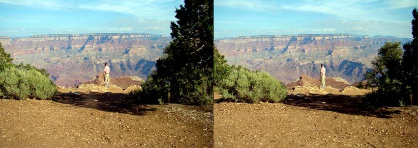
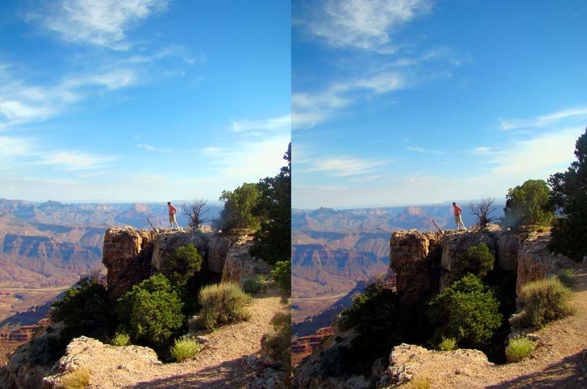
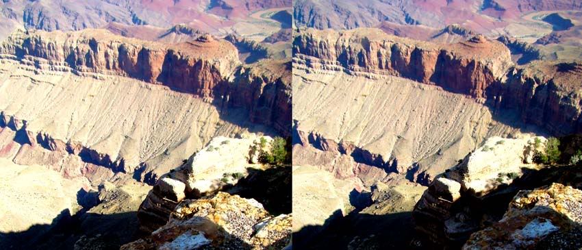
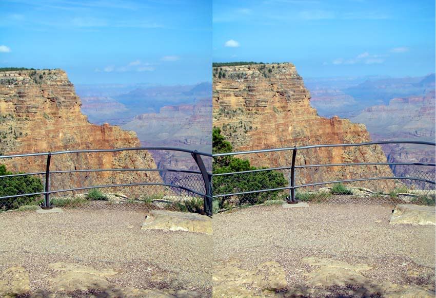
Here are My Photos:
Next post (hopefully tomorrow) Antelope Canyon and the wonder of Slot Canyons.
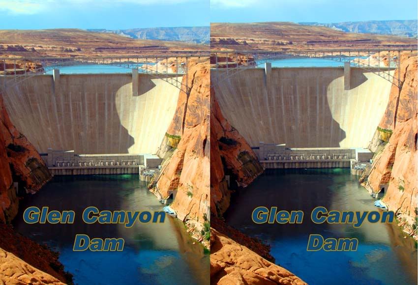
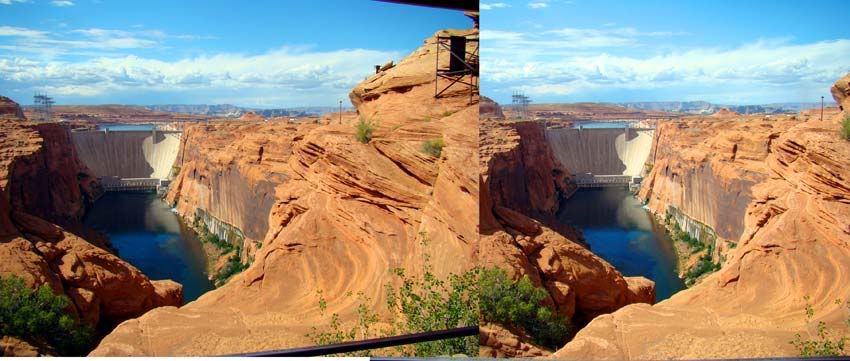
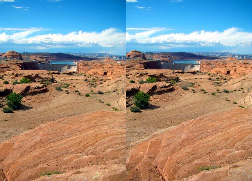
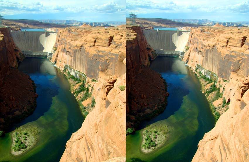
Canyon-Country.com writes the following about the Glen Canyon Dam which resulted in the creation of Lake Powell:
On October 15, 1956, the first blast occurred and the construction of Glen Canyon Dam was officially underway. Before that date, the site was virtually inaccessible and construction crews were forced to drive 200 miles to cross from one side of Glen Canyon to the other.
The remote location was selected for the project by a group of Bureau of Reclamation engineers and geologist working from 1946 to 1948. The site met several criteria: the area forming the basin could contain an immense amount of water; the canyon walls and bedrock foundation were strong and stable enough to safely support the high dam; and a large source of good rock and sand was available at nearby Wahweap Creek.
By 1959, the Glen Canyon Bridge was completed permitting the trucks to deliver equipment and materials for the dam and the new town of Page Arizona.
The next year concrete placement began and continued night and day until the final bucket was dumped three years later. A bucket held 24 tons of damp concrete and it took over 400,000 of them to build the dam. Over five million cubic yards of concrete make up the dam and power plant -- that's equal to enough to build a four-lane highway stretching from Phoenix, Arizona to Chicago, Illinois. Construction began on the 3,700 foot dam with blocks of concrete 7.5 feet high.
Next, turbines and generators were installed from 1963 to 1966. The dam was dedicated by Ladybird Johnson on September 22, 1966. It took 17 years for lake Powell to completely fill for the first time.
The plant generates more than 1.3 million kilowatts of electricity with each of the 40-ton steel shafts turning at 150 rpm, generating nearly 200,000 horsepower. With all eight generators operating at full output, over 15 million gallons of water will pass through the power plant's penstocks each minute. The electricity is upgraded on a transformer deck from 13,800 volts to 230,000 and 345,000 volts for transmission to distant markets.
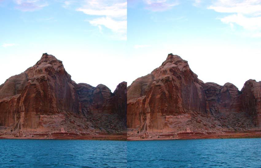
During the evening we took a dining cruise on Lake Powell. With the boat moving, the waves, the wind and lack of light at that time of day all resulted in rather poor quality 3D photos. Below is the only photo I took that evening which I consder worth posting.
Next post (tomorrow I hope) we visit Horseshoe Bend, just South of Glen Canyon Dam.
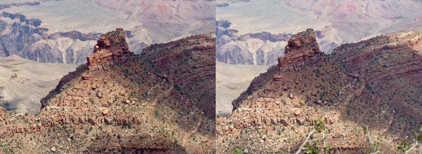
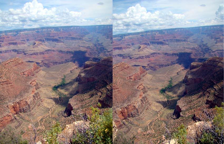
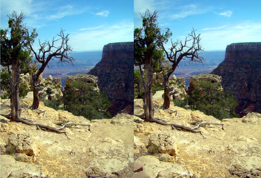
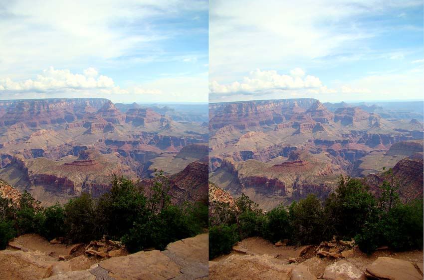
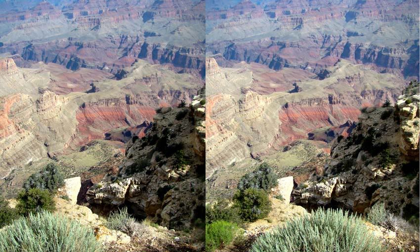
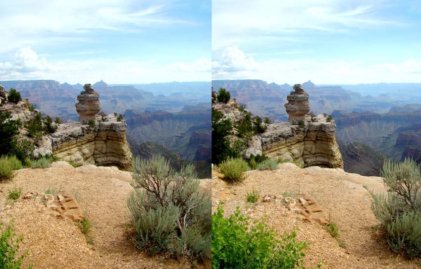
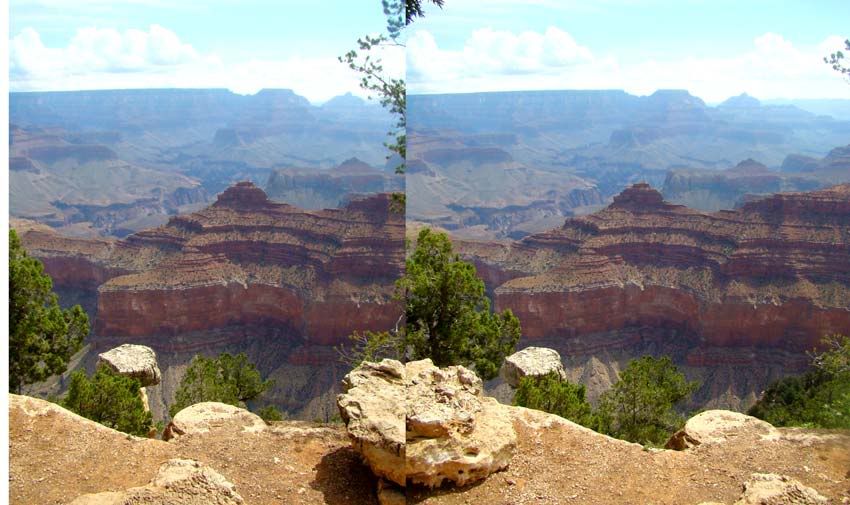
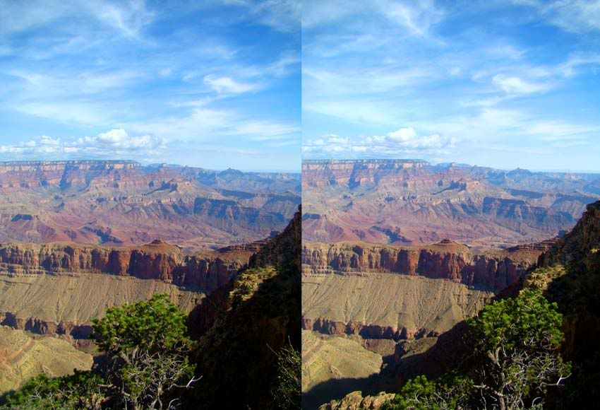
The USA Today Travel Web site has one of the best descriptions I could find of the Grand Canyon. It can be viewed here, and says:
OVERVIEW:
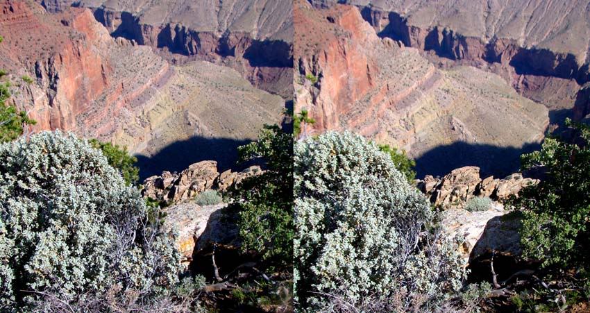
If there is any place on Earth that puts into perspective the grandiosity of Mother Nature, it is the Grand Canyon. The natural wonder, located in northern Arizona, is a window into the region's geological and Native American past. As one of the country's first national parks, the Grand Canyon has long been considered a U.S. treasure, and continues to inspire scientific study and puzzlement.
I found this Fantastic 360 interactive panorama of The Grand Canyon and thought I would let you all see it. I encourage you to visit the host web site, it is well worth the visit. Click here
The Grand Canyon is estimated to be five to six million years old, and the three "Granite Gorges" found here contain crystalline rocks created during the Proterozoic Era. The rare existence of layered rock gives scientists a look into the area's history, dating back two million years. In 1858, scientists began to study the canyon to determine the nature and progression of geologic processes in the area. Even though the Grand Canyon supplies nature-lovers with an escape from society, people have inhabited the area for thousands of years. Archaeologists have uncovered artifacts dating as far back as the Paleo-Indian period, 12,000 years ago. An intensive survey of only three percent of the park has resulted in the discovery of around 4,800 archeological resources.
GEOLOGY:
The 277-mile canyon varies in width between 600 feet and 18 miles, and is one-mile-deep. One of the things that makes the Grand Canyon so grand is that its dry climate keeps the gorge from widening, leading to its extraordinary depths. The canyon is late Cenozoic feature, and consists of four plateaus carved by the Colorado River. The canyon's walls are made up of nearly 40 rock layers, and cinder cones a situated at the western end of the chasm, between the area's two most active faults, Hurricane and Toroweap. The greatest mystery of the Grand Canyon is the Kaibab limestone found at its top layer. The deposit was created at the bottom of the ocean, and was somehow uplifted 9,000 feet, where it sits today.
It is my hope these photos, in some small way, did justice to this World Wonder. Next we move north to our final destination on this vacation, Lake Powell.
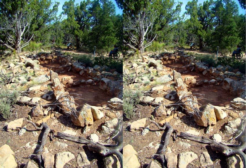
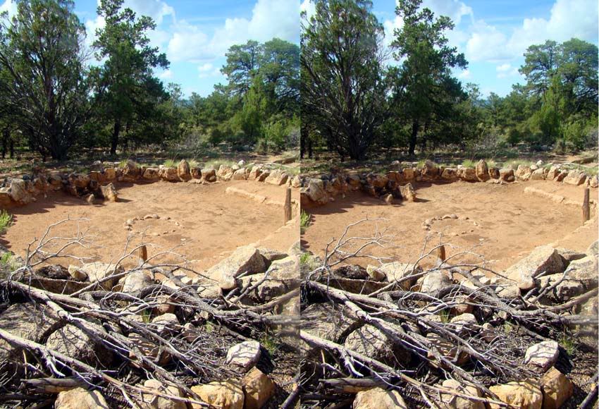
A visit to Tusayan Ruins and Museum provides a glimpse into the life of the Hopi tribe and the Ancestral Puebloan people who inhabited the region 800 years ago. Inside the museum, there are artfully displayed exhibits on various aspects of life in the village including pottery, arrowheads, and other household artifacts. The museum also features some of the original 2,000–4,000 year old split-twig figurines, which are made in the shape of deer or bighorn sheep, sometimes with horns or antlers.
The Tusayan Ruins and Museum is part of the Grand Canyon South Rim’s Desert View Drive. The trail itself holds a variety of attractions including Desert View, the breathtaking scenery unfolding from Desert View Watchtower, Navajo Point, where you can see the Colorado River and Escalante Butte, and Lipan Point, where you can see several stretches of the Colorado River. Also here is Moran Point, where you can see a layer of red shale in the canyon walls